Working...

Cheyenne Bottoms
World-renowned Wetlands
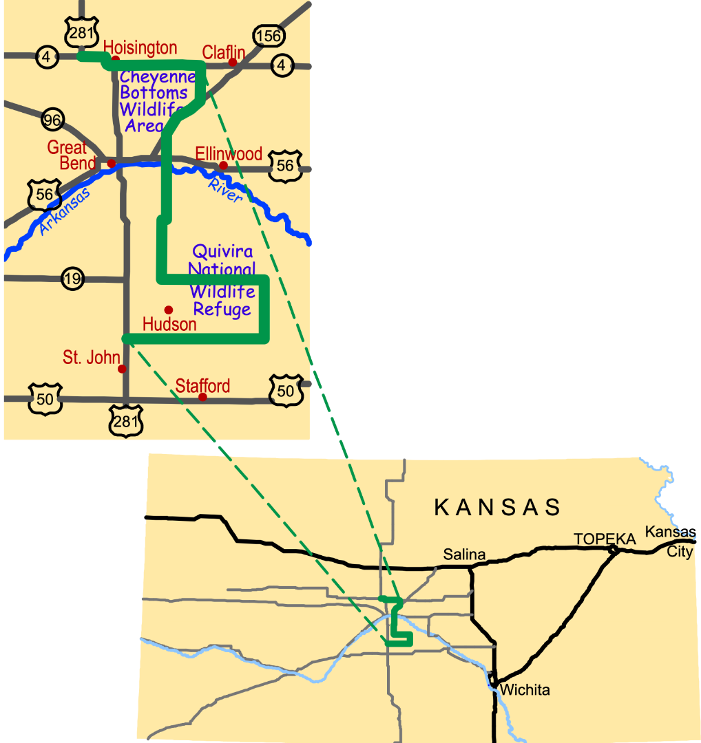
The largest interior marsh in the United States, Cheyenne Bottoms is one of the most important shorebird migration stopover points in the Western Hemisphere. More than half of all shorebirds that migrate east of the Rockies pass through this 40,000-acre lowland, including 90% of North America's population of Wilson's phalarope, long-billed dowitcher, white-rumped sandpiper, Baird's sandpiper, and stilt sandpiper.
Bordered on three sides by low bluffs, Cheyenne Bottoms lies in a natural basin* that traps water from the Blood and Deception Creeks. Maintaining the Bottom's mosaic of aquatic habitats - large, small, shallow, deep, weedy, and open - requires careful management. The Kansas Department of Wildlife, Parks and Tourism uses dikes, pumps, and water diversions to control water levels on the nearly 20,000 acres it manages. The Nature Conservancy manages nearly 8,000 acres, restoring grassland and marsh habitat with rotational grazing, prescribed fires, and other management techniques to create a diversity in vegetation.
The Kansas Wetlands Education Center at Cheyenne Bottoms
A joint project of the Kansas Department of Wildlife, Parks and Tourism and the Sternberg Museum of Natural History at Fort Hays State University, the Kansas Wetlands Education Center interprets the wetlands and wildlife of Cheyenne Bottoms. Visitors are welcome, so be sure to stop as you travel the Byway.
Motion and Change
Named a "Wetland of International Importance" by the Ramsar Convention on Wetlands, Cheyenne Bottoms was once threatened by conversion to agriculture and diminishing water supply. In the 1990s, the Kansas Department of Wildlife, Parks and Tourism secured funding for renovations to safeguard this world-renowned natural area.
Download the interpretive panel: Cheyenne Bottoms Panel located at the rest area on K-156 Hwy across from KWEC.
To listen to more information click on the Audio TourTrack #3
Go to the Gallery to view photographs contributed by visitors to the Byway.
* Natural Basin
"Cheyenne Bottoms is a natural land sink approximately 41,000 acres in size. It has been a marsh for at least 100,000 years. The people of Kansas own 20,000 acres of that 41,000 acre basin. And it is managed by the Kansas Department of Wildlife, Parks and Tourism. The Nature Conservancy owns and manages an additional 8,000 acres. The balance of it is still in private hands. So of the 41,000 [acres], 28,000 acres of that entire Bottoms basin is managed for wildlife.".
-Karl Grover, Cheyenne Bottoms Wildlife Manager, Kansas Dept. of Wildlife, Parks and Tourism
If you stand at the Cheyenne Bottoms Scenic Overlook, atop the 100-foot bluffs that circle the basin on three sides, you can see that Cheyenne Bottoms is a giant, 65-square-mile depression in the prairie landscape. Geologists debate the origins of this basin. The most widely accepted theory is that ground water dissolved the salt beds that underlay this area, forming a vast sinkhole.
The Overlook reveals a panorama of large pools of water, marshes, mudflats, and grasslands that draw so much wildlife to the Bottoms. In the State Wildlife Area, managers have created a series of holding cells in which they trap water and redirect it as needed across the management area.
Cheyenne Bottoms is a critical stopping/resting point for migrating shorebirds-roughly forty-five percent of all shorebirds in North America stop at the Bottoms during spring migration! Most are stopping to rest and re-build body fat for the next leg of their journey. Some stay and nest, such as killdeer, American avocet, snowy plovers, upland and spotted sandpipers and Wilson's phalarope.
For more information, visit the Cheyenne Bottoms website. Cheyenne Bottoms
Kansas Department of Wildlife, Parks and Tourism offers excellent and extensive information on Cheyenne Bottoms wildlife, hunting, general refuge information, driving tours, and much more on their website. KS Dept of Wildlife, Parks and Tourism/Hunting
More Wetlands pages...
Quivira National Wildlife Refuge
Arkansas River's Great Bend