Working...

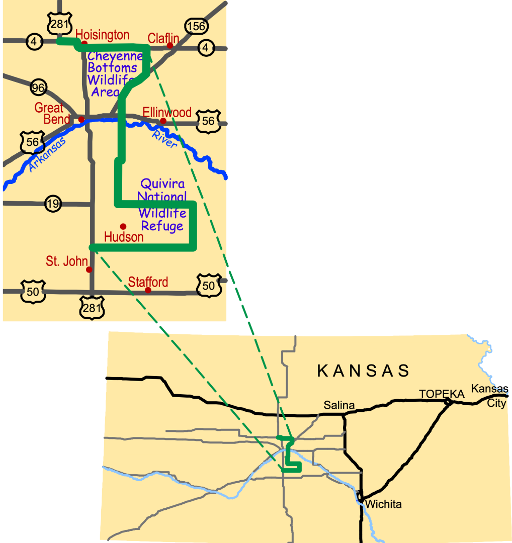
The Arkansas River's Great Bend
Inch Deep, Mile Wide
The Arkansas River is one of America's iconic rivers, coursing 1,469 miles before merging with the Mississippi River. Here in central Kansas, its steady east-southeast flow is interrupted by a wide northward sweep called the "great bend." The city of Great Bend lies at this meandering river's northernmost point.
A wild mountain stream as it surges from the Rockies, the Arkansas transforms in the Great Plains into a braided river, much like the Platte and Canadian Rivers. In a braided river, several small channels wander within a broad, shallow river bed. Indeed, the Arkansas River flood plain widens to nearly eight miles in eastern Barton County!
The Arkansas River carries sediment from the Rockies, which drops out as the river slows along the "great bend." Dispersed by floods, these sediments build fertile soils. This region's only river, the Arkansas has shaped much of what you see along the Byway.
"Ar-Kansas"
Here in Kansas, we pronounce the river's name, "Ar-Kansas." Ask Kansans why, and they might tell you, "Because we don't live in "Kan-saw!" Our pronunciation sensibly combines the state's name with its most prominent feature-the sweeping "arc" the river makes through this region.
Fording the Arkansas*
As the river crosses this region, a low limestone bluff lines its north bank. In the 1800s, this limited the places where wagons could cross. Just east of Ellinwood, a gap in the bluff became the region's first wagon "ford."
Motion and Change
Refuge staff mimic natural patterns when managing Quivira National Wildlife Refuge. Bison once roamed these grasslands. Now cattle graze here, carefully managed to replicate the beneficial effects of bison herds. Lightning strikes and native peoples ignited fires that encouraged lush new grasses. Likewise, the refuge uses fire to renew the prairie.
Download the interpretive panel: Arkansas River's Great Bend Panel located at the Barton County Historical Museum and Village on US-281 south of Great Bend.
To listen to more information click on the Audio Tour
Go to the Gallery to view photographs contributed by visitors to the Byway.
* Fording the Arkansas
When you see the Arkansas River today, fording it might not seem difficult. But the Arkansas River is a shadow of its former self, much-changed since settlement days. Now, dams, irrigation, and low-rainfall in Colorado and in western Kansas draw off much of the river's flow before it reaches central Kansas.
Here's how Washington Irving described the Arkansas River when he visited Barton County in 1832:
"After resuming our march we came in sight of the Arkansas. It presented a broad and rapid stream bordered by a beach of fine sand, overgrown with willows and cottonwood trees. Beyond the river the eye wandered over a beautiful campaign country of flowery plains and sloping uplands, diversified by groves and clumps of trees and long screens of woodland; the whole wearing the aspect of complete and even ornamental cultivation, instead of native wilderness."
-Excerpted from Biographical Sketch of Barton County, Kansas, 1912.
More Wetlands pages...
Cheyenne Bottoms
Quivira National Wildlife Refuge